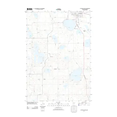
2013 Map of Litchfield South
USGS Topo · Published 2013About this map
Litchfield serves as the northern anchor for this agricultural and glacial lake region in Meeker County. The landscape is defined by its numerous water bodies, including Lake Ripley, Lake Minnie-Belle, and Lake Harold, which have long shaped the local recreational and residential patterns. In the southern portion of the map, the small settlements of Strout and Beckville remain as historical touchpoints in a territory largely dedicated to dairy farming and aviation, as seen with Barka Dairy and the L & M Aerodrome. A clear grid of township roads connects various generational landmarks like the Nelson Farm and Ness Cem. This 2013 survey illustrates the modern configuration of transportation, specifically the corridor of Minnesota Highway 22 as it bypasses E Lake Ripley and heads toward the Litchfield Municipal Airport, documenting the persistent rural character of the Minnesota prairie.
Find a feature on this map
88 named features on this map. Tap any name to fly to it.
Don’t see what you’re looking for? This feature index may not catch every label — zoom into the map to look around manually.
Map Details
Editions of this 2013 Litchfield South Map
This is the sole edition of this map. No revisions or reprints were ever made.
Other maps of this area

1953 · New Ulm
USGS Topo · 1:250,000

1953 · Saint Cloud
USGS Topo · 1:250,000

1957 · Saint Cloud
USGS Topo · 1:250,000

1957 · New Ulm
USGS Topo · 1:250,000

1958 · New Ulm
USGS Topo · 1:250,000

1958 · Saint Cloud
USGS Topo · 1:250,000

1958 · Dassel
USGS Topo · 1:62,500

1958 · Hutchinson
USGS Topo · 1:62,500

1967 · New Ulm
USGS Topo · 1:250,000

1967 · Grove City
USGS Topo · 1:24,000