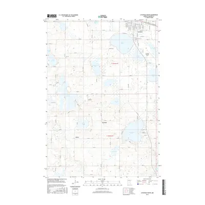
2016 Map of Litchfield South
USGS Topo · Published 2016About this map
Lake Ripley dominates the landscape just south of Litchfield, serving as a central geographical landmark for this portion of Meeker County. This 2016 survey reveals a transition from the structured street grid of the southern town limits, including W Ripley St and S Holcombe Ave, into a rural expanse characterized by numerous glacial basins. Small, established communities like Beckville and Strout anchor the southern reaches of the map, while historical burial grounds such as Ness Cem and Lake Ripley Cem provide vital touchpoints for local genealogists. Aviation history is also present through both the Litchfield Municipal Airport and the L & M Aerodrome. The terrain is defined by a high density of water bodies, ranging from the large Lake Minnie-Belle to smaller features like Youngstrom Lake and Chicken Lake, illustrating the complex hydrology of the region.
Find a feature on this map
90 named features on this map. Tap any name to fly to it.
Don’t see what you’re looking for? This feature index may not catch every label — zoom into the map to look around manually.
Map Details
Editions of this 2016 Litchfield South Map
This is the sole edition of this map. No revisions or reprints were ever made.
Other maps of this area

1953 · New Ulm
USGS Topo · 1:250,000

1953 · Saint Cloud
USGS Topo · 1:250,000

1957 · Saint Cloud
USGS Topo · 1:250,000

1957 · New Ulm
USGS Topo · 1:250,000

1958 · New Ulm
USGS Topo · 1:250,000

1958 · Saint Cloud
USGS Topo · 1:250,000

1958 · Dassel
USGS Topo · 1:62,500

1958 · Hutchinson
USGS Topo · 1:62,500

1967 · New Ulm
USGS Topo · 1:250,000

1967 · Grove City
USGS Topo · 1:24,000