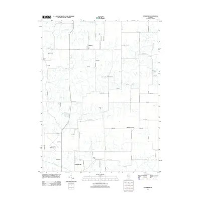
2012 Map of Literberry
USGS Topo · Published 2012About this map
Literberry serves as the central hub of this agricultural landscape in Morgan County, where the grid of rural roads connects several small settlements and family landmarks. The map illustrates a high density of historical burial sites, including the Liter Cem, Arcadia Cem, and the uniquely named Rücker Cem, which provide significant anchor points for local genealogical research. To the west, the village of Arcadia sits near Henderson McFadden Cem, while the southern reaches are dominated by the Jacksonville Municipal Airport and the distinctively labeled Portuguese Hill. Waterways like Indian Cr and Snake Cr carve through the prairie, leading toward the prominent Cavanaugh Bluff in the east. This survey captures a rural Illinois community defined by its proximity to transit and its deep-rooted cemeteries, offering a clear view of the area's development before further modernization.
Find a feature on this map
77 named features on this map. Tap any name to fly to it.
Don’t see what you’re looking for? This feature index may not catch every label — zoom into the map to look around manually.
Map Details
Editions of this 2012 Literberry Map
This is the sole edition of this map. No revisions or reprints were ever made.
Other maps of this area

1924 · Winchester
USGS Topo · 1:48,000

1926 · Winchester
USGS Topo · 1:62,500

1929 · Arenzville
USGS Topo · 1:62,500

1932 · Arenzville
USGS Topo · 1:62,500

1932 · Jacksonville
USGS Topo · 1:62,500

1932 · Virginia
USGS Topo · 1:62,500

1936 · Virginia
USGS Topo · 1:62,500

1937 · Jacksonville
USGS Topo · 1:62,500

1948 · Quincy
USGS Topo · 1:250,000

1956 · Quincy
USGS Topo · 1:250,000