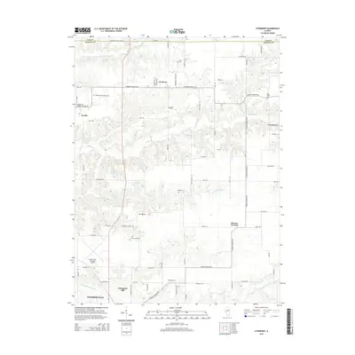
2015 Map of Literberry
USGS Topo · Published 2015About this map
Literberry and Arcadia anchor this rural landscape in northern Morgan County, where the terrain is defined by the winding paths of Indian Cr and Snake Cr. The map reveals a dense network of family history sites, including the Liter Cem, Rucker Cem, and the Henderson-McFadden Cem north of the village of Arcadia. To the south, the northern edge of Jacksonville begins to emerge, marked by the Jacksonville Municipal Airport and the residential area of Portuguese Hill. The agricultural character of the region is punctuated by prominent physical landmarks like Cavanaugh Bluff and local water bodies such as Freitag Lake and Valevue Lake. This 2015 survey provides a modern look at the long-standing community junctions at Strawns Crossing and the persistent rural road grid that has connected these settlements for generations.
Find a feature on this map
75 named features on this map. Tap any name to fly to it.
Don’t see what you’re looking for? This feature index may not catch every label — zoom into the map to look around manually.
Map Details
Editions of this 2015 Literberry Map
This is the sole edition of this map. No revisions or reprints were ever made.
Other maps of this area

1924 · Winchester
USGS Topo · 1:48,000

1926 · Winchester
USGS Topo · 1:62,500

1929 · Arenzville
USGS Topo · 1:62,500

1932 · Arenzville
USGS Topo · 1:62,500

1932 · Jacksonville
USGS Topo · 1:62,500

1932 · Virginia
USGS Topo · 1:62,500

1936 · Virginia
USGS Topo · 1:62,500

1937 · Jacksonville
USGS Topo · 1:62,500

1948 · Quincy
USGS Topo · 1:250,000

1956 · Quincy
USGS Topo · 1:250,000