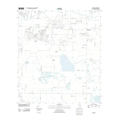
2012 Map of Lithia
USGS Topo · Published 2012About this map
Lithia Springs and the winding course of the Alafia River dominate this landscape, which transitioned from traditional Florida hammocks to residential developments by the early twenty-first century. The map preserves the names of several distinct topographical elevations and forested islands within the terrain, including Coleman Hammock, Chapman Hammock, and Stallion Hammock. These features are interspersed with an intricate network of waterways like Fishhawk Cr and Chito Br. While the northern section shows denser settlement patterns around Lithia and Pinecrest, the southern portion near Picnic retains a more rural character. This era of the landscape is marked by a blend of old local landmarks, such as the Lithia Cem and Po, alongside modern aviation infrastructure like Stanchester Airport, illustrating the suburban expansion of Hillsborough County.
Find a feature on this map
107 named features on this map. Tap any name to fly to it.
Don’t see what you’re looking for? This feature index may not catch every label — zoom into the map to look around manually.
Map Details
Editions of this 2012 Lithia Map
This is the sole edition of this map. No revisions or reprints were ever made.
Other maps of this area

1921 · Tampa
USGS Topo · 1:62,500

1944 · Mango
USGS Topo · 1:31,680

1944 · Wimauma
USGS Topo · 1:31,680

1944 · Balm
USGS Topo · 1:31,680

1947 · Wimauma
USGS Topo · 1:25,000

1955 · Lithia
USGS Topo · 1:24,000

1955 · Nichols
USGS Topo · 1:24,000

1955 · Dover
USGS Topo · 1:24,000

1955 · Keysville
USGS Topo · 1:24,000
1956 · Riverview
USGS Topo · 1:24,000