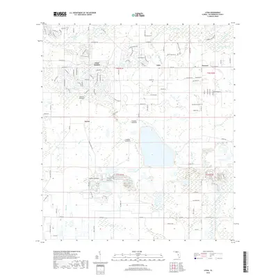
2018 Map of Lithia
USGS Topo · Published 2018About this map
The Alafia River flows through the northern reaches of this landscape, fed by tributaries like McCullough Branch and McDonald Branch. The community of Lithia and the residential expansion of Fish Hawk represent the shifting character of eastern Hillsborough County. To the south, the terrain becomes increasingly defined by distinct wetlands and ecological formations known as hammocks, including Coleman Hammock, Chapman Hammock, and Stallion Hammock.
Find a feature on this map
118 named features on this map. Tap any name to fly to it.
Don’t see what you’re looking for? This feature index may not catch every label — zoom into the map to look around manually.
Map Details
Editions of this 2018 Lithia Map
This is the sole edition of this map. No revisions or reprints were ever made.
Other maps of this area

1921 · Tampa
USGS Topo · 1:62,500

1944 · Mango
USGS Topo · 1:31,680

1944 · Wimauma
USGS Topo · 1:31,680

1944 · Balm
USGS Topo · 1:31,680

1947 · Wimauma
USGS Topo · 1:25,000

1955 · Lithia
USGS Topo · 1:24,000

1955 · Nichols
USGS Topo · 1:24,000

1955 · Dover
USGS Topo · 1:24,000

1955 · Keysville
USGS Topo · 1:24,000
1956 · Riverview
USGS Topo · 1:24,000