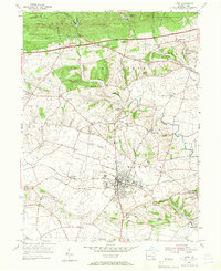
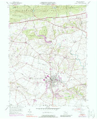
1956 Map of Lititz
USGS Topo · Published 1966About this map
The Furnace Hills rise sharply along the northern edge of this mid-century survey, a stark contrast to the dense network of farmsteads and rural institutions that define the valley below. At the heart of the landscape, the borough of Lititz serves as a cultural and educational hub, notable for the historic Linden Hall Sch and the proximity of the Warwick High Sch. The region's deep religious roots are evident in the sheer number of denominational landmarks, from the Old Zion Ch and Coleman Chapel to the Union Meetinghouse near Millport.
Find a feature on this map
70 named features on this map. Tap any name to fly to it.
Don’t see what you’re looking for? This feature index may not catch every label — zoom into the map to look around manually.
Map Details
Editions of this 1956 Lititz Map
5 editions found
Other maps of this area

1891 · Lebanon
USGS Topo · 1:62,500

1893 · Lebanon
USGS Topo · 1:62,500

1899 · Lebanon
USGS Topo · 1:62,500

1902 · Wernersville
USGS Topo · 1:62,500

1902 · Lancaster
USGS Topo · 1:62,500

1904 · Lancaster
USGS Topo · 1:62,500

1906 · New Holland
USGS Topo · 1:62,500

1908 · New Holland
USGS Topo · 1:62,500

1941 · New Holland
USGS Topo · 1:62,500

1943 · Lancaster
USGS Topo · 1:62,500