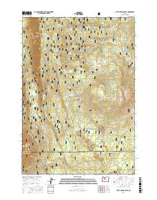
2017 Map of Little Akawa Butte
USGS Topo · Published 2017About this map
Green Ridge dominates the western flank of this landscape within the Deschutes National Forest, where the high volcanic terrain of the Cascade Range meets the plateau. This 2017 survey details a complex network of forest development roads and trails, such as the Metolius-Windigo and Upper Butte Loops, which serve the timber and recreation interests of both Jefferson and Deschutes counties. The area is defined by its volcanic geology, including Little Akawa Butte and Garrison Butte, alongside drainage features like Fly Cr and Akawa Gulch. Rare water sources in this arid timberland are marked by scattered springs, including Bear Spring, Whiskey Spring, and Summit Spring. The map provides an essential look at the modern management of these public lands, showing the intersection of historical survey lines and contemporary forest access.
Find a feature on this map
50 named features on this map. Tap any name to fly to it.
Don’t see what you’re looking for? This feature index may not catch every label — zoom into the map to look around manually.
Map Details
Editions of this 2017 Little Akawa Butte Map
This is the sole edition of this map. No revisions or reprints were ever made.
Other maps of this area

1926 · Bend
USGS Topo · 1:125,000

1927 · Mt. Jefferson
USGS Topo · 1:125,000

1928 · Madras
USGS Topo · 1:125,000

1929 · Bend
USGS Topo · 1:125,000

1929 · Three Sisters
USGS Topo · 1:125,000

1930 · Mt. Jefferson
USGS Topo · 1:125,000

1931 · Madras
USGS Topo · 1:125,000

1932 · Three Sisters
USGS Topo · 1:125,000

1955 · Bend
USGS Topo · 1:250,000

1957 · Bend
USGS Topo · 1:250,000