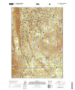
2020 Map of Little Akawa Butte
USGS Topo · Published 2020About this map
Deschutes National Forest encompasses the entirety of this landscape, where the volcanic topography of the Cascade Range meets the high plateaus of Central Oregon. The prominent volcanic profile of Little Akawa Butte and the smaller Garrison Butte anchor the eastern terrain, while the extensive Green Ridge escarpment runs north-to-south across the western half of the map. This area is defined by a sparse but vital network of water sources, including Bear Spring, Whiskey Spring, and Aborn Spring, which have historically served as critical stops in an otherwise arid timberland. Recreation and resource management define the modern movement through these woods, evidenced by the established Metolius-Windigo route and the Upper Butte Loops that navigate the slopes. The Jefferson and Deschutes county line bisects the southern reaches, marking a transition point between these two high-desert jurisdictions.
Find a feature on this map
21 named features on this map. Tap any name to fly to it.
Don’t see what you’re looking for? This feature index may not catch every label — zoom into the map to look around manually.
Map Details
Editions of this 2020 Little Akawa Butte Map
This is the sole edition of this map. No revisions or reprints were ever made.
Other maps of this area

1926 · Bend
USGS Topo · 1:125,000

1927 · Mt. Jefferson
USGS Topo · 1:125,000

1928 · Madras
USGS Topo · 1:125,000

1929 · Bend
USGS Topo · 1:125,000

1929 · Three Sisters
USGS Topo · 1:125,000

1930 · Mt. Jefferson
USGS Topo · 1:125,000

1931 · Madras
USGS Topo · 1:125,000

1932 · Three Sisters
USGS Topo · 1:125,000

1955 · Bend
USGS Topo · 1:250,000

1957 · Bend
USGS Topo · 1:250,000