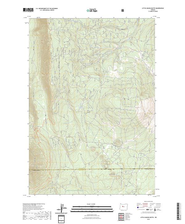
2023 Map of Little Akawa Butte
USGS Topo · Published 2023About this map
Green Ridge dominates the western skyline of this high-country landscape, defining the northern reaches of the Deschutes National Forest. The map documents a rugged section of the Cascade Range where the boundary between Jefferson and Deschutes counties traverses a series of volcanic features including Little Akawa Butte and Garrison Butte. This territory is characterized by a network of recreational and historical routes, notably the Metolius-Windigo Trl and the Green Ridge Trl, which navigate the steep elevation changes. A scattering of reliable water sources like Whiskey Spring, Bear Spring, and Thorn Spring highlights the importance of these points for both wildlife and travelers in an area where Fly Creek provides the primary drainage. The transition from the high ridge down to The Gap illustrates the complex topography of the Oregon volcanic arc.
Find a feature on this map
21 named features on this map. Tap any name to fly to it.
Don’t see what you’re looking for? This feature index may not catch every label — zoom into the map to look around manually.
Map Details
Editions of this 2023 Little Akawa Butte Map
This is the sole edition of this map. No revisions or reprints were ever made.
Other maps of this area

1926 · Bend
USGS Topo · 1:125,000

1927 · Mt. Jefferson
USGS Topo · 1:125,000

1928 · Madras
USGS Topo · 1:125,000

1929 · Bend
USGS Topo · 1:125,000

1929 · Three Sisters
USGS Topo · 1:125,000

1930 · Mt. Jefferson
USGS Topo · 1:125,000

1931 · Madras
USGS Topo · 1:125,000

1932 · Three Sisters
USGS Topo · 1:125,000

1955 · Bend
USGS Topo · 1:250,000

1957 · Bend
USGS Topo · 1:250,000