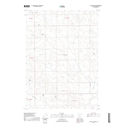
2017 Map of Little Alkali Creek
USGS Topo · Published 2017About this map
The Cheyenne River flows through the southern reaches of this corner of Niobrara County, where the high plains are carved by an intricate network of seasonal drainages. This landscape is defined by its dramatic nomenclature, featuring landmarks such as Bridle Bit Hill and several uniquely named depressions including Hungry Hollow and Fatal Hollow. These names suggest a history of ranching and the challenges of the Wyoming frontier.
Find a feature on this map
19 named features on this map. Tap any name to fly to it.
Don’t see what you’re looking for? This feature index may not catch every label — zoom into the map to look around manually.
Map Details
Editions of this 2017 Little Alkali Creek Map
This is the sole edition of this map. No revisions or reprints were ever made.
Other maps of this area

1899 · Newcastle
USGS Topo · 1:125,000

1901 · Newcastle
USGS Topo · 1:125,000

1951 · Dewey SW
USGS Topo · 1:24,000

1955 · Newcastle
USGS Topo · 1:250,000

1958 · Newcastle
USGS Topo · 1:250,000

1978 · Riverview
USGS Topo · 1:24,000

1978 · Mule Creek
USGS Topo · 1:24,000

1979 · Newcastle
USGS Topo · 1:100,000

1981 · Threemile Butte
USGS Topo · 1:24,000
1981 · Little Alkali Creek
USGS Topo · 1:24,000