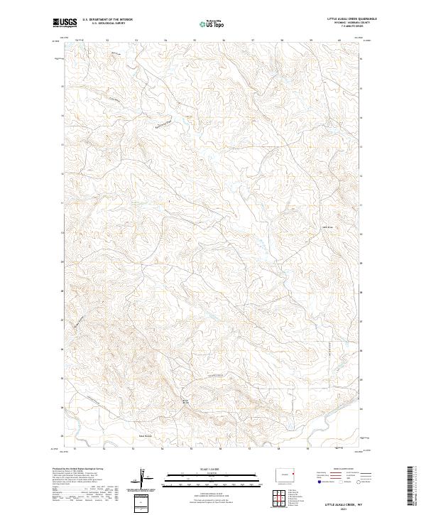
2021 Map of Little Alkali Creek
USGS Topo · Published 2021About this map
Cheyenne River winds through the southern reaches of this Wyoming landscape, providing the primary drainage for a network of named draws and hollows. The terrain is defined by its watercourses, including Little Alkali Cr, Buck Camp Cr, and Bobcat Cr, which carve through the high plains. The map reveals a land utilized for ranching and transit, evidenced by the presence of Cheyenne River Rd and distinctive landmarks such as Bridle Bit Hill.
Find a feature on this map
19 named features on this map. Tap any name to fly to it.
Don’t see what you’re looking for? This feature index may not catch every label — zoom into the map to look around manually.
Map Details
Editions of this 2021 Little Alkali Creek Map
This is the sole edition of this map. No revisions or reprints were ever made.
Other maps of this area

1899 · Newcastle
USGS Topo · 1:125,000

1901 · Newcastle
USGS Topo · 1:125,000

1951 · Dewey SW
USGS Topo · 1:24,000

1955 · Newcastle
USGS Topo · 1:250,000

1958 · Newcastle
USGS Topo · 1:250,000

1978 · Riverview
USGS Topo · 1:24,000

1978 · Mule Creek
USGS Topo · 1:24,000

1979 · Newcastle
USGS Topo · 1:100,000

1981 · Threemile Butte
USGS Topo · 1:24,000
1981 · Little Alkali Creek
USGS Topo · 1:24,000