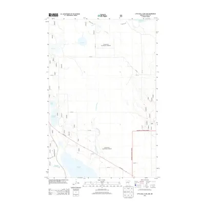
2013 Map of Little Ball Club Lake
USGS Topo · Published 2013About this map
Chippewa National Forest encompasses the wetlands and timberlands of this Itasca County landscape, where the First River meanders toward its confluence at Ball Club Lake. This 2013 survey reveals a sparsely populated terrain dominated by hydrologic features, including the Ball Club Impoundment and the secluded Little Ball Club Lake. The road network consists primarily of county routes and forest service roads like Forest Rd 2346, supporting logging or recreational access. State Hwy 46 cuts diagonally through the southern portion, serving as the primary corridor through the forest. Water drainage patterns are clearly defined by Fishermans Brook, which connects smaller basins like Egg Lake and Tuttle Lake within the protected forest boundaries. This map offers a detailed look at the modern management of these northern Minnesota headwaters and forest preserves.
Find a feature on this map
23 named features on this map. Tap any name to fly to it.
Don’t see what you’re looking for? This feature index may not catch every label — zoom into the map to look around manually.
Map Details
Editions of this 2013 Little Ball Club Lake Map
This is the sole edition of this map. No revisions or reprints were ever made.
Other maps of this area

1919 · Max
USGS Topo · 1:62,500

1954 · Bemidji
USGS Topo · 1:250,000

1954 · Hibbing
USGS Topo · 1:250,000

1957 · Bemidji
USGS Topo · 1:250,000

1957 · Hibbing
USGS Topo · 1:250,000

1958 · Bemidji
USGS Topo · 1:250,000

1958 · Hibbing
USGS Topo · 1:250,000

1964 · Hibbing
USGS Topo · 1:250,000

1970 · Bowstring Lake
USGS Topo · 1:24,000

1970 · Deer River NE
USGS Topo · 1:24,000