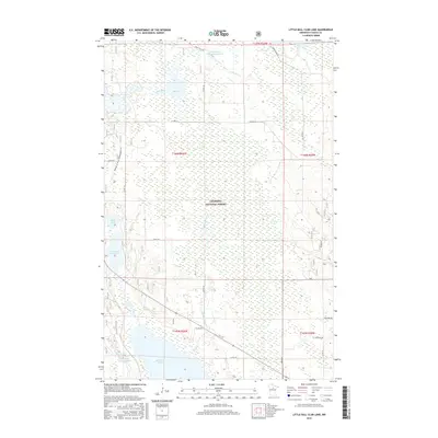
2016 Map of Little Ball Club Lake
USGS Topo · Published 2016About this map
Chippewa National Forest dominates this landscape in northern Minnesota, where a complex network of wetlands and open water defines the local geography. The area is characterized by major water bodies including Ball Club Lake and Little Ball Club Lake, which are interconnected by drainages like Fishermans Brook. The presence of the Ball Club Impoundment and Egg Lake Impoundment indicates active water management within this protected timber and wilderness area. In addition to natural features like Egg Lake and Tutile Lake, the map traces local transit and recreation routes, such as the Avenue of Pines Snowmobile Tr and various county roads including Co Hwy 37. This 2016 survey provides a clear view of the modern boundaries and hydrography within the Leech Lake Indian Reservation vicinity, illustrating how the First River system weaves through the heavily forested terrain.
Find a feature on this map
28 named features on this map. Tap any name to fly to it.
Don’t see what you’re looking for? This feature index may not catch every label — zoom into the map to look around manually.
Map Details
Editions of this 2016 Little Ball Club Lake Map
This is the sole edition of this map. No revisions or reprints were ever made.
Other maps of this area

1919 · Max
USGS Topo · 1:62,500

1954 · Bemidji
USGS Topo · 1:250,000

1954 · Hibbing
USGS Topo · 1:250,000

1957 · Bemidji
USGS Topo · 1:250,000

1957 · Hibbing
USGS Topo · 1:250,000

1958 · Bemidji
USGS Topo · 1:250,000

1958 · Hibbing
USGS Topo · 1:250,000

1964 · Hibbing
USGS Topo · 1:250,000

1970 · Bowstring Lake
USGS Topo · 1:24,000

1970 · Deer River NE
USGS Topo · 1:24,000