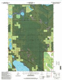
1996 Map of Little Ball Club Lake
USGS Topo · Published 1998About this map
Ball Club Lake dominates the southern reaches of this landscape, its expansive waters and intricate shoreline defining the transition between the Chippewa National Forest and the Bowstring State Forest. Surveyed in the late 20th century, the map reveals a highly managed aquatic ecosystem, featuring the Egg Lake Impoundment and Ball Club Impoundment, which control water levels across the marshy lowland. The northern drainage is shaped by the winding First River, which connects First River Lake and Egg Lake through a dense network of wetlands.
Find a feature on this map
20 named features on this map. Tap any name to fly to it.
Don’t see what you’re looking for? This feature index may not catch every label — zoom into the map to look around manually.
Map Details
Editions of this 1996 Little Ball Club Lake Map
This is the sole edition of this map. No revisions or reprints were ever made.
Other maps of this area

1919 · Max
USGS Topo · 1:62,500

1954 · Bemidji
USGS Topo · 1:250,000

1954 · Hibbing
USGS Topo · 1:250,000

1957 · Bemidji
USGS Topo · 1:250,000

1957 · Hibbing
USGS Topo · 1:250,000

1958 · Bemidji
USGS Topo · 1:250,000

1958 · Hibbing
USGS Topo · 1:250,000

1964 · Hibbing
USGS Topo · 1:250,000

1970 · Bowstring Lake
USGS Topo · 1:24,000

1970 · Deer River NE
USGS Topo · 1:24,000