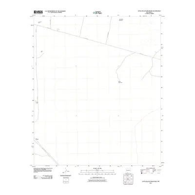
2010 Map of Little Black Mountain
USGS Topo · Published 2010About this map
Little Black Mountain and the larger Black Mountain rise from the desert floor in this southern New Mexico quadrangle, providing a vertical relief that defines the sparse landscape. This 2010 survey illustrates a region largely characterized by isolated outposts and a network of arterial roads, including W Afton Rd and County Rd B009. The map records specific points of settlement and resource management like Fitzgerald Ranch in the north and Nunn Ranch further south along Afton Rd. These locations, along with Grimm Well, suggest a long-standing reliance on groundwater and ranching infrastructure. Near the southwestern edge, the community of Rutter sits along County Rd A012, representing the primary human footprint in an otherwise open terrain. The mapping detail serves as a clear record of the area's rural transportation and ranching boundaries during the early 21st century.
Find a feature on this map
10 named features on this map. Tap any name to fly to it.
Don’t see what you’re looking for? This feature index may not catch every label — zoom into the map to look around manually.
Map Details
Editions of this 2010 Little Black Mountain Map
This is the sole edition of this map. No revisions or reprints were ever made.
Other maps of this area

1891 · Las Cruces
USGS Topo · 1:125,000

1893 · Las Cruces
USGS Topo · 1:125,000

1917 · Canutillo
USGS Topo · 1:62,500

1917 · Noria
USGS Topo · 1:62,500

1918 · Noria
USGS Topo · 1:62,500

1919 · Canutillo
USGS Topo · 1:62,500

1943 · La Mesa
USGS Topo · 1:62,500

1943 · Afton
USGS Topo · 1:62,500

1953 · El Paso
USGS Topo · 1:250,000
1955 · San Miguel
USGS Topo · 1:24,000