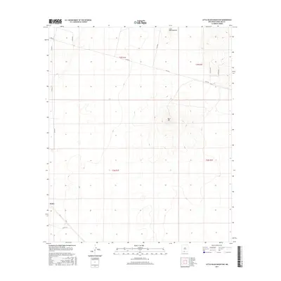
2017 Map of Little Black Mountain
USGS Topo · Published 2017About this map
Black Mtn dominates the central landscape of this southern New Mexico region, rising above the arid plains of Doña Ana County. This 2017 topographic survey highlights the sparse human imprint on the terrain, defined largely by the intersection of rural thoroughfares such as Afton Rd and Co Rd B008. The settlement of Rutter appears in the southwestern corner, situated along a local road network that cuts through the desert floor. To the north, the smaller peak of Little Black Mountain provides a secondary landmark for navigation. The map illustrates the grid system of the Public Land Survey System, dividing the area into sections across T25S and T26S, illustrating how modern land management and road access have been structured around these prominent volcanic features.
Find a feature on this map
9 named features on this map. Tap any name to fly to it.
Don’t see what you’re looking for? This feature index may not catch every label — zoom into the map to look around manually.
Map Details
Editions of this 2017 Little Black Mountain Map
This is the sole edition of this map. No revisions or reprints were ever made.
Other maps of this area

1891 · Las Cruces
USGS Topo · 1:125,000

1893 · Las Cruces
USGS Topo · 1:125,000

1917 · Canutillo
USGS Topo · 1:62,500

1917 · Noria
USGS Topo · 1:62,500

1918 · Noria
USGS Topo · 1:62,500

1919 · Canutillo
USGS Topo · 1:62,500

1943 · La Mesa
USGS Topo · 1:62,500

1943 · Afton
USGS Topo · 1:62,500

1953 · El Paso
USGS Topo · 1:250,000
1955 · San Miguel
USGS Topo · 1:24,000