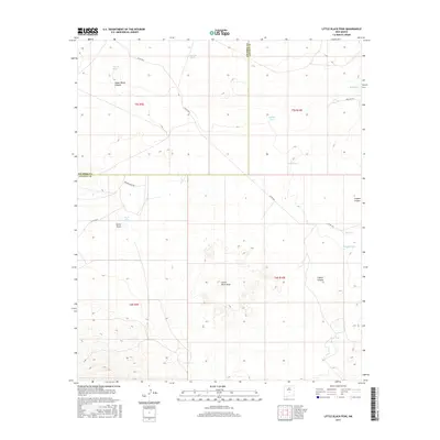
2017 Map of Little Black Peak
USGS Topo · Published 2017About this map
Little Black Peak rises from the high desert floor of Lincoln County, marking a prominent volcanic feature in a landscape defined by arroyos and canyons. The 2017 survey reveals a network of vital water infrastructure scattered across this arid terrain, where named catchments like Grumble Tank, Billy Bob Tank, and Ashbey Tank serve as critical landmarks for local land management and ranching operations. The terrain transitions from the open expanses around Duck Lake and Red Lake to more carved topographies, such as Upper Ranch Canyon and Coyote Canyon, which intersect the central and eastern portions of the map.
Find a feature on this map
21 named features on this map. Tap any name to fly to it.
Don’t see what you’re looking for? This feature index may not catch every label — zoom into the map to look around manually.
Map Details
Editions of this 2017 Little Black Peak Map
This is the sole edition of this map. No revisions or reprints were ever made.
Other maps of this area

1918 · Oscura Peak
USGS Topo · 1:125,000

1938 · Carrizozo
USGS Topo · 1:48,000

1943 · Carrizozo
USGS Topo · 1:62,500

1948 · Broken Back Crater
USGS Topo · 1:62,500

1948 · Chihuahua Ranch
USGS Topo · 1:62,500

1950 · Carrizozo
USGS Topo · 1:62,500

1950 · Little Black Peak
USGS Topo · 1:62,500

1954 · Tularosa
USGS Topo · 1:250,000

1955 · Roswell
USGS Topo · 1:250,000

1958 · Roswell
USGS Topo · 1:250,000