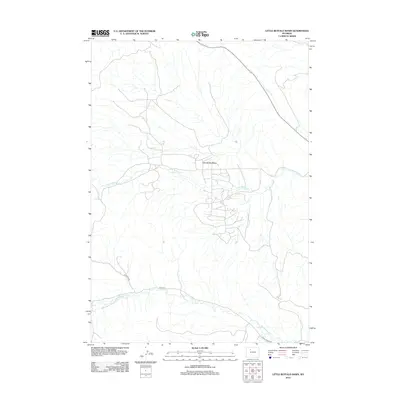
2012 Map of Little Buffalo Basin
USGS Topo · Published 2012About this map
Little Buffalo Basin dominates this landscape in Park County, defined by a complex network of industrial and access roads servicing what is traditionally one of Wyoming's significant oil and gas fields. The drainage patterns of Little Buffalo Cr and Buffalo Cr carve through the basin, illustrating the stark interplay between the natural high-desert hydrology and intensive energy infrastructure. To the south, the terrain descends toward Gooseberry Cr, where more isolated ranching routes like Dickie Ranch Rd and the utilitarian Road 4cp provide the primary transit through the arid, hilly reaches near Rooster Crk. The map reveals the modern footprint of resource extraction in the early 21st century, showing how specialized road networks have been etched into the Wyoming backcountry to support the basin's economic output.
Find a feature on this map
8 named features on this map. Tap any name to fly to it.
Don’t see what you’re looking for? This feature index may not catch every label — zoom into the map to look around manually.
Map Details
Editions of this 2012 Little Buffalo Basin Map
This is the sole edition of this map. No revisions or reprints were ever made.
Other maps of this area

1911 · Meeteetse
USGS Topo · 1:62,500

1913 · Meeteetse
USGS Topo · 1:62,500

1913 · Grass Creek Basin
USGS Topo · 1:62,500

1915 · Grass Creek Basin
USGS Topo · 1:62,500

1951 · Hillberry Rim
USGS Topo · 1:24,000

1951 · Wilson Spring
USGS Topo · 1:24,000

1955 · Cody
USGS Topo · 1:250,000

1955 · Thermopolis
USGS Topo · 1:250,000

1956 · Soapy Dale Peak
USGS Topo · 1:24,000

1956 · Adam Weiss Peak
USGS Topo · 1:24,000