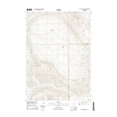
2015 Map of Little Buffalo Basin
USGS Topo · Published 2015About this map
Little Buffalo Basin dominates this landscape along the border of Park and Hot Springs counties. The area is defined by a sparse network of watercourses and access roads including Little Buffalo Basin Rd and W Gooseberry Rd. Several drainages converge in this high-elevation terrain, most notably Little Buffalo Cr and Buffalo Cr in the northern half, while Gooseberry Cr and Middle Cr carve through the southern sections. This 2015 survey illustrates the modern public land survey system divisions across township lines, showing a remote region primarily managed for its natural resources and geographic features rather than dense settlement.
Find a feature on this map
13 named features on this map. Tap any name to fly to it.
Don’t see what you’re looking for? This feature index may not catch every label — zoom into the map to look around manually.
Map Details
Editions of this 2015 Little Buffalo Basin Map
This is the sole edition of this map. No revisions or reprints were ever made.
Other maps of this area

1911 · Meeteetse
USGS Topo · 1:62,500

1913 · Meeteetse
USGS Topo · 1:62,500

1913 · Grass Creek Basin
USGS Topo · 1:62,500

1915 · Grass Creek Basin
USGS Topo · 1:62,500

1951 · Hillberry Rim
USGS Topo · 1:24,000

1951 · Wilson Spring
USGS Topo · 1:24,000

1955 · Cody
USGS Topo · 1:250,000

1955 · Thermopolis
USGS Topo · 1:250,000

1956 · Soapy Dale Peak
USGS Topo · 1:24,000

1956 · Adam Weiss Peak
USGS Topo · 1:24,000