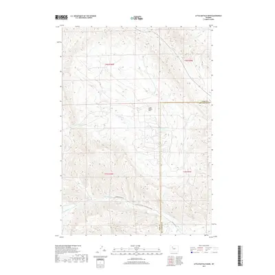
2017 Map of Little Buffalo Basin
USGS Topo · Published 2017About this map
Little Buffalo Basin dominates the central landscape of this Wyoming quadrangle, where the borders of Park and Hot Springs counties meet. This area, largely defined by its drainage systems, is etched with the courses of Buffalo Cr and Little Buffalo Cr in the north, while the southern portion is crossed by Gooseberry Cr and Middle Cr. The presence of industrial and agricultural transit routes, such as the Lu Ranch Rd/Encore Oil Rd/Upper Gooseber and Dickie Ranch Rd, points to the intersection of the region's ranching heritage and energy resources. These roads follow the natural contours of the basin, connecting the sparse high-country infrastructure. The mapping also delineates township and range lines across t48n r100w and t47n r99w, providing a framework for land ownership and resource management in this corner of the state.
Find a feature on this map
13 named features on this map. Tap any name to fly to it.
Don’t see what you’re looking for? This feature index may not catch every label — zoom into the map to look around manually.
Map Details
Editions of this 2017 Little Buffalo Basin Map
This is the sole edition of this map. No revisions or reprints were ever made.
Other maps of this area

1911 · Meeteetse
USGS Topo · 1:62,500

1913 · Meeteetse
USGS Topo · 1:62,500

1913 · Grass Creek Basin
USGS Topo · 1:62,500

1915 · Grass Creek Basin
USGS Topo · 1:62,500

1951 · Hillberry Rim
USGS Topo · 1:24,000

1951 · Wilson Spring
USGS Topo · 1:24,000

1955 · Cody
USGS Topo · 1:250,000

1955 · Thermopolis
USGS Topo · 1:250,000

1956 · Soapy Dale Peak
USGS Topo · 1:24,000

1956 · Adam Weiss Peak
USGS Topo · 1:24,000