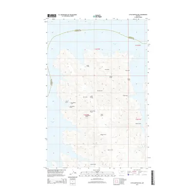
2014 Map of Little Buffalo Hill
USGS Topo · Published 2014About this map
Fort Peck Lake dominates the northern and western margins of this map, its intricate, branching shoreline defining the boundary between Valley and Garfield counties. This part of the Missouri River basin is characterized by a dense network of coulees that drain the surrounding high ground, including Little Buffalo Hill. The terrain shows the deeply eroded breaks typical of the region, where seasonal drainage channels like Beebe and Stanton Coulee have carved intricate paths toward the reservoir.
Find a feature on this map
18 named features on this map. Tap any name to fly to it.
Don’t see what you’re looking for? This feature index may not catch every label — zoom into the map to look around manually.
Map Details
Editions of this 2014 Little Buffalo Hill Map
This is the sole edition of this map. No revisions or reprints were ever made.
Other maps of this area

1954 · Jordan
USGS Topo · 1:250,000

1956 · Jordan
USGS Topo · 1:250,000

1958 · Jordan
USGS Topo · 1:250,000

1958 · Collins Ranch
USGS Topo · 1:62,500

1958 · Maloney Hill
USGS Topo · 1:62,500
1958 · Seventh Point Buttes
USGS Topo · 1:24,000

1964 · Jordan
USGS Topo · 1:250,000
1972 · Kester School
USGS Topo · 1:24,000
1972 · Signal Butte
USGS Topo · 1:24,000

1978 · Fort Peck Lake East
USGS Topo · 1:100,000