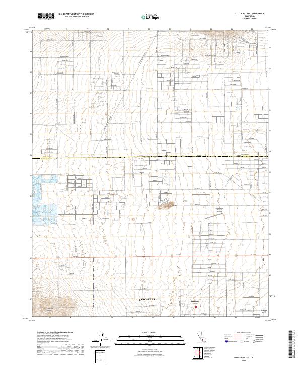
2021 Map of Little Buttes
USGS Topo · Published 2021About this map
Antelope Valley defines the arid character of this high desert landscape, situated along the border of Kern and Los Angeles Counties. The grid-based settlement of Antelope Acres and the northern outskirts of Lancaster demonstrate the spread of residential development across the flat valley floor, governed by a rigid network of desert boulevards such as Rosamond Blvd and Gaskell Rd. Rising abruptly from the plains are the Little Buttes and Antelope Buttes, serving as prominent geologic markers in an otherwise uniform terrain.
Find a feature on this map
113 named features on this map. Tap any name to fly to it.
Don’t see what you’re looking for? This feature index may not catch every label — zoom into the map to look around manually.
Map Details
Editions of this 2021 Little Buttes Map
This is the sole edition of this map. No revisions or reprints were ever made.
Other maps of this area

1915 · Elizabeth Lake
USGS Topo · 1:125,000

1917 · Elizabeth Lake
USGS Topo · 1:125,000

1931 · Little Buttes
USGS Topo · 1:24,000

1931 · Esperanza School
USGS Topo · 1:24,000

1934 · Little Buttes
USGS Topo · 1:24,000

1934 · Esperanza School
USGS Topo · 1:24,000

1943 · Rosamond
USGS Topo · 1:62,500

1943 · Willow Springs
USGS Topo · 1:62,500
1947 · Rosamond
USGS Topo · 1:24,000

1947 · Soledad Mountain
USGS Topo · 1:24,000