
1960 Map of Little Chicago
USGS Topo · Published 1961About this map
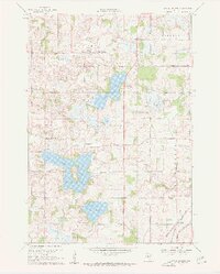
Little Chicago and Millersburg anchor this 1960 survey of Rice and Dakota Counties, revealing a landscape defined by glacial lakes and a trio of major railroads. The southeastern corner is a busy transit corridor where the Chicago Milwaukee St Paul and Pacific, Chicago Rock Island and Pacific, and Chicago Great Western lines converge near Comus. This density of rail transport contrasts with the quiet rural character of Webster and Forest townships, where civic and spiritual life is marked by the Townhall, Christdala Ch, and Rolling Green Ch.
Find a feature on this map
27 named features on this map. Tap any name to fly to it.
Don’t see what you’re looking for? This feature index may not catch every label — zoom into the map to look around manually.
Map Details
Editions of this 1960 Little Chicago Map
2 editions found
Other maps of this area

1953 · Saint Paul
USGS Topo · 1:250,000

1957 · Farmington
USGS Topo · 1:62,500

1957 · Prior Lake
USGS Topo · 1:62,500

1959 · Saint Paul
USGS Topo · 1:250,000

1960 · Faribault
USGS Topo · 1:24,000

1960 · Northfield
USGS Topo · 1:24,000

1960 · Cannon City
USGS Topo · 1:24,000

1960 · Shieldsville
USGS Topo · 1:24,000

1960 · Lonsdale
USGS Topo · 1:24,000
1974 · New Market
USGS Topo · 1:24,000