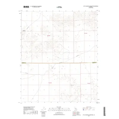
2018 Map of Little Chuckwalla Mountains
USGS Topo · Published 2018About this map
The Chuckwalla Mountains rise sharply in the northern portion of this quadrangle, creating a distinct topographical divide as the desert floor transitions into the Black Hills to the south. Historically significant pathways traverse this arid landscape, including The Bradshaw Trl, a vital nineteenth-century stage route, and the Butterfield Trl. The survey captures the crossing of these trails near the boundary of Riverside and Imperial Counties, highlighting the corridor's role as a transit artery through the Colorado Desert. Settlement here is defined by these travel routes rather than towns, with Graham Pass Rd providing one of the few formal access points through the high terrain.
Find a feature on this map
10 named features on this map. Tap any name to fly to it.
Don’t see what you’re looking for? This feature index may not catch every label — zoom into the map to look around manually.
Map Details
Editions of this 2018 Little Chuckwalla Mountains Map
This is the sole edition of this map. No revisions or reprints were ever made.
Other maps of this area

1942 · Blythe
USGS Topo · 1:250,000

1952 · Mc Coy Spring
USGS Topo · 1:62,500

1952 · Sidewinder Well
USGS Topo · 1:62,500

1953 · Palo Verde Mountains
USGS Topo · 1:62,500

1953 · Chuckwalla Spring
USGS Topo · 1:62,500

1954 · Salton Sea
USGS Topo · 1:250,000

1955 · Salton Sea
USGS Topo · 1:250,000

1959 · Salton Sea
USGS Topo · 1:250,000

1963 · Salton Sea
USGS Topo · 1:250,000

1965 · Salton Sea
USGS Topo · 1:250,000