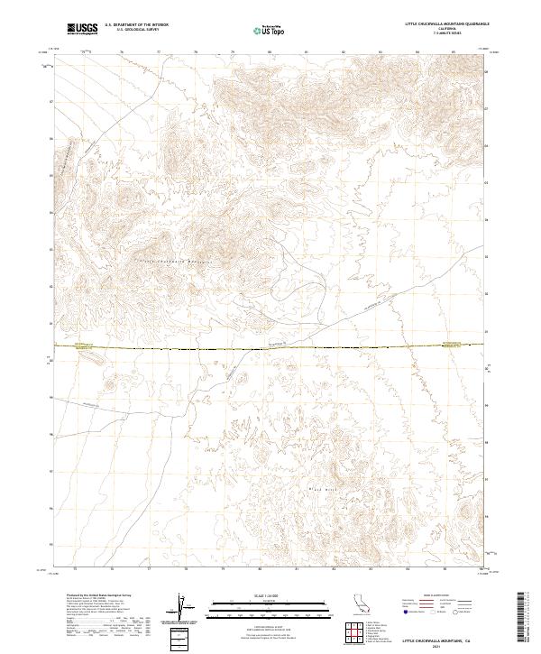
2021 Map of Little Chuckwalla Mountains
USGS Topo · Published 2021About this map
The Little Chuckwalla Mountains dominate this high-desert landscape, where the rugged terrain transitions between the Colorado Desert's vast basins. This particular region is defined by its historic transportation corridors, most notably the The Bradshaw Trl, a vital nineteenth-century stage route that once connected the Colorado River to the coast. The map also traces the Butterfield Trl and Graham Pass Rd, showing how these ancient paths negotiate the gaps between the Chuckwalla Mountains and the surrounding alluvial plains. Straddling the boundary of Riverside and Imperial Counties, the area remains largely undeveloped, preserving the spatial relationship between these historic trails and the prominent peaks that served as landmarks for early travelers and pioneers navigating the California interior.
Find a feature on this map
10 named features on this map. Tap any name to fly to it.
Don’t see what you’re looking for? This feature index may not catch every label — zoom into the map to look around manually.
Map Details
Editions of this 2021 Little Chuckwalla Mountains Map
This is the sole edition of this map. No revisions or reprints were ever made.
Other maps of this area

1942 · Blythe
USGS Topo · 1:250,000

1952 · Mc Coy Spring
USGS Topo · 1:62,500

1952 · Sidewinder Well
USGS Topo · 1:62,500

1953 · Palo Verde Mountains
USGS Topo · 1:62,500

1953 · Chuckwalla Spring
USGS Topo · 1:62,500

1954 · Salton Sea
USGS Topo · 1:250,000

1955 · Salton Sea
USGS Topo · 1:250,000

1959 · Salton Sea
USGS Topo · 1:250,000

1963 · Salton Sea
USGS Topo · 1:250,000

1965 · Salton Sea
USGS Topo · 1:250,000