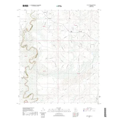
2018 Map of Little Creek
USGS Topo · Published 2018About this map
The Little River winds through the lowlands of central Louisiana, forming a natural boundary between Grant Parish and LaSalle Parish. This 2018 survey documents a landscape defined by its wetland networks and industrial infrastructure, where the broad reach of Bayou Funny Louis meets smaller drainages like Sulphur Creek and Jones Creek. Small communities such as Little Creek, Ganeyville, and Zenoria anchor the rural landscape, connected by a dense web of access routes including Oil Field Road and Tram Road. Significant local-history markers are scattered throughout the region, including several family-named landmarks and resting places like Chalk Hill Cemetery and Hawthorne Cemetery. The southern reaches of the map show an intricate system of lakes and sloughs, notably Moon Lake, Horseshoe Lake, and Nugent Brake, illustrating the seasonal ebb and flow of the surrounding river system.
Find a feature on this map
74 named features on this map. Tap any name to fly to it.
Don’t see what you’re looking for? This feature index may not catch every label — zoom into the map to look around manually.
Map Details
Editions of this 2018 Little Creek Map
This is the sole edition of this map. No revisions or reprints were ever made.
Other maps of this area

1936 · Pollock
USGS Topo · 1:62,500

1941 · Jena
USGS Topo · 1:62,500

1941 · Pollock
USGS Topo · 1:62,500

1953 · Alexandria
USGS Topo · 1:250,000

1954 · Tullos
USGS Topo · 1:62,500

1955 · Alexandria
USGS Topo · 1:250,000

1955 · Olla
USGS Topo · 1:62,500

1958 · Pollock
USGS Topo · 1:62,500

1958 · Jena
USGS Topo · 1:62,500
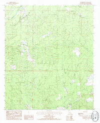
1984 · Summerville
USGS Topo · 1:24,000