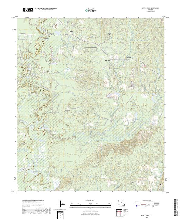
2024 Map of Little Creek
USGS Topo · Published 2024About this map
Little Creek and Ganeyville sit atop the ridges of the Louisiana pinewoods where the Grant Parish and LaSalle Parish line bisects the bottomlands. This landscape is defined by the shifting course of the Little River, which feeds a series of oxbow lakes and brakes including Horseshoe Lake, Blue Lake, and Nugent Brake. The network of timber and petroleum access roads, such as Oil Field Rd and Chalk Hill Cemetery Rd, reflects the area's industrial reliance on the surrounding forest and underlying resources. Historical transit points are still noted along the river, including Campbells Ferry and Rambeaus Ferry, marking where travelers once crossed the water before modern infrastructure. Higher ground is marked by landmarks like Doughty Bluff and local burial sites such as Chalk Hill Cem and Hawthorne Cem, which serve as vital touchstones for family historians and genealogists in this part of central Louisiana.
Find a feature on this map
75 named features on this map. Tap any name to fly to it.
Don’t see what you’re looking for? This feature index may not catch every label — zoom into the map to look around manually.
Map Details
Editions of this 2024 Little Creek Map
This is the sole edition of this map. No revisions or reprints were ever made.
Other maps of this area

1936 · Pollock
USGS Topo · 1:62,500

1941 · Jena
USGS Topo · 1:62,500

1941 · Pollock
USGS Topo · 1:62,500

1953 · Alexandria
USGS Topo · 1:250,000

1954 · Tullos
USGS Topo · 1:62,500

1955 · Alexandria
USGS Topo · 1:250,000

1955 · Olla
USGS Topo · 1:62,500

1958 · Pollock
USGS Topo · 1:62,500

1958 · Jena
USGS Topo · 1:62,500
1984 · Summerville
USGS Topo · 1:24,000