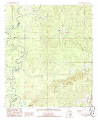
1985 Map of Little Creek
USGS Topo · Published 1985About this map
The Little River defines the western edge of this mid-1980s landscape, winding through a complex of oxbows and swampy depressions like Horseshoe Lake, Hub Lake, and Devils Brake. This region along the Grant and La Salle Parish line is characterized by its intricate drainage network, where Lincecum Bayou and Funny Louis Bayou feed into the river system. Settlement is sparse and concentrated near the northern border at Zenoria and Jones, or further east at Little Creek and Ganeyville. The industrial footprint of the era is evident through an Abandoned RR corridor and a designated Oil Field, reflecting the timber and energy extraction history of the piney woods and bottomlands. To the south, numerous branches like Gotch Branch and Big Branch drain the higher ground toward the bayous.
Find a feature on this map
29 named features on this map. Tap any name to fly to it.
Don’t see what you’re looking for? This feature index may not catch every label — zoom into the map to look around manually.
Map Details
Editions of this 1985 Little Creek Map
This is the sole edition of this map. No revisions or reprints were ever made.
Other maps of this area

1936 · Pollock
USGS Topo · 1:62,500

1941 · Jena
USGS Topo · 1:62,500

1941 · Pollock
USGS Topo · 1:62,500

1953 · Alexandria
USGS Topo · 1:250,000

1954 · Tullos
USGS Topo · 1:62,500

1955 · Alexandria
USGS Topo · 1:250,000

1955 · Olla
USGS Topo · 1:62,500

1958 · Pollock
USGS Topo · 1:62,500

1958 · Jena
USGS Topo · 1:62,500
1984 · Summerville
USGS Topo · 1:24,000