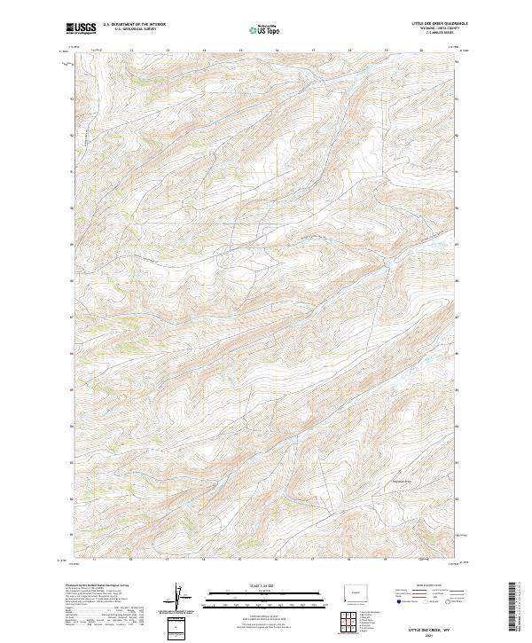
2021 Map of Little Dee Creek
USGS Topo · Published 2021About this map
High-altitude drainage basins define this portion of Uinta County, where several seasonal and perennial streams carve through the landscape south of the Utah border. The topography is anchored by the winding course of Little Dee Cr, which flows through the center of the quadrangle before its waters are joined by tributaries like Shurtleff Cr and Ruckman Cr. In the southern reaches, the land descends toward Haystack Draw and the banks of Clear Cr. This is a working landscape, evidenced by the presence of the Whitney Canyon Haul Rd, a specialized route built to support the region's energy and industrial transport. The map also shows Carter Creek Rd skirting the western edge, providing one of the few points of access into this high-country terrain.
Find a feature on this map
13 named features on this map. Tap any name to fly to it.
Don’t see what you’re looking for? This feature index may not catch every label — zoom into the map to look around manually.
Map Details
Editions of this 2021 Little Dee Creek Map
This is the sole edition of this map. No revisions or reprints were ever made.
Other maps of this area

1954 · Ogden
USGS Topo · 1:250,000

1958 · Ogden
USGS Topo · 1:250,000

1960 · Ogden
USGS Topo · 1:250,000

1962 · Sawtooth Mountain
USGS Topo · 1:24,000

1962 · Elkol SW
USGS Topo · 1:24,000

1962 · Bell Butte
USGS Topo · 1:24,000

1965 · Evanston
USGS Topo · 1:24,000

1965 · Ragan
USGS Topo · 1:24,000

1965 · Little Dee Creek
USGS Topo · 1:24,000

1965 · Meadow Draw
USGS Topo · 1:24,000