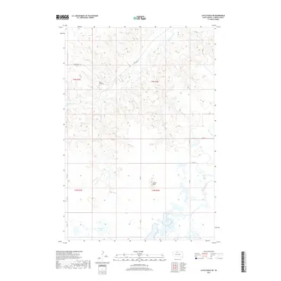
2017 Map of Little Eagle SW
USGS Topo · Published 2017About this map
Good Shepherd Church Cem serves as a significant local landmark in this prairie landscape of Corson County. The terrain is defined by the elevation of Saddle Butte, which rises above a network of seasonal drainages including High Bank Cr and Little Oak Cr. This 2017 survey reflects the remote character of the Standing Rock Reservation area, where water is the primary geographic anchor. Large bodies of water like Dogeagle Lake and Spring Lake dot the southern half of the quadrangle, connected by a simple grid of section-line roads such as Co Rd 11 and Firesteel Rd. The map illustrates a rural settlement pattern where isolated community structures and family names are preserved through the names of these natural features and landmarks.
Find a feature on this map
20 named features on this map. Tap any name to fly to it.
Don’t see what you’re looking for? This feature index may not catch every label — zoom into the map to look around manually.
Map Details
Editions of this 2017 Little Eagle SW Map
This is the sole edition of this map. No revisions or reprints were ever made.
Other maps of this area

1953 · McIntosh
USGS Topo · 1:250,000

1956 · Little Eagle SW
USGS Topo · 1:24,000

1956 · Little Eagle
USGS Topo · 1:24,000

1956 · Little Eagle SE
USGS Topo · 1:24,000

1956 · Miscol SE
USGS Topo · 1:24,000

1956 · Little Eagle NW
USGS Topo · 1:24,000

1956 · Miscol NE
USGS Topo · 1:24,000

1958 · McIntosh
USGS Topo · 1:250,000

1975 · Glencross
USGS Topo · 1:24,000
1975 · Glencross NE
USGS Topo · 1:24,000