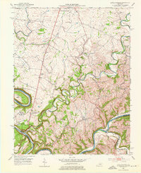
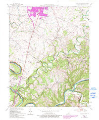
1952 Map of Little Hickman
USGS Topo · Published 1976About this map
The winding Kentucky River forms the defining southern boundary of this region, carving deep meanders like Pollys Bend into the limestone landscape. At the western edge, Camp Nelson serves as a significant historical focal point, situated near the Camp Nelson National Cem and the legendary Daniel Boones Cave overlooking the river cliffs. This 1950s landscape is characterized by its network of rural schools and country churches that anchored community life, including Sulphur Well Sch, Crisman Mill Sch, and Wesley Chapel.
Find a feature on this map
35 named features on this map. Tap any name to fly to it.
Don’t see what you’re looking for? This feature index may not catch every label — zoom into the map to look around manually.
Map Details
Editions of this 1952 Little Hickman Map
6 editions found
Other maps of this area

1892 · Richmond
USGS Topo · 1:125,000

1897 · Richmond
USGS Topo · 1:125,000

1905 · Harrodsburg
USGS Topo · 1:125,000

1950 · Bryantsville
USGS Topo · 1:24,000

1952 · Keene
USGS Topo · 1:24,000

1952 · Valley View
USGS Topo · 1:24,000

1952 · Little Hickman
USGS Topo · 1:24,000

1952 · Nicholasville
USGS Topo · 1:24,000

1952 · Buckeye
USGS Topo · 1:24,000

1952 · Coletown
USGS Topo · 1:24,000