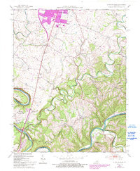
1952 Map of Little Hickman
USGS Topo · Published 1993About this map
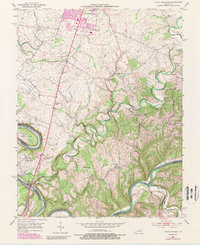
The Kentucky River carves a dramatic path through the Bluegrass landscape, defining the jagged boundaries between Jessamine, Garrard, and Madison Counties. This 1952 survey, updated with 1988 data, illustrates a region rooted in small agrarian settlements and river history. Notable rural communities like Little Hickman and Hanly are connected by winding roads and several country churches, including Roberts Chapel and Ebenezer Ch. Significant local landmarks include the Camp Nelson National Cem and Daniel Boones Cave, located near the sharp oxbow of Pollys Bend. While the northern edge shows the expansion of Nicholasville, much of the area remains characterized by its complex hydrology, with the Hickman Creek drainage system and the notable Sulphur Well school and namesake water feature serving as central points for local genealogists and historians.
Find a feature on this map
37 named features on this map. Tap any name to fly to it.
Don’t see what you’re looking for? This feature index may not catch every label — zoom into the map to look around manually.
Map Details
Editions of this 1952 Little Hickman Map
6 editions found
Other maps of this area

1892 · Richmond
USGS Topo · 1:125,000

1897 · Richmond
USGS Topo · 1:125,000

1905 · Harrodsburg
USGS Topo · 1:125,000

1950 · Bryantsville
USGS Topo · 1:24,000

1952 · Keene
USGS Topo · 1:24,000

1952 · Valley View
USGS Topo · 1:24,000

1952 · Little Hickman
USGS Topo · 1:24,000

1952 · Nicholasville
USGS Topo · 1:24,000

1952 · Buckeye
USGS Topo · 1:24,000

1952 · Coletown
USGS Topo · 1:24,000