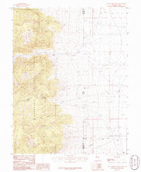
1986 Map of Little Horse Canyon
USGS Topo · Published 1986About this map
Humboldt National Forest dominates the western half of this 1980s landscape, where steep terrain gives way to the high desert flats of the Nevada and Utah border. The transition from mountain to basin is marked by a network of drainage systems, including Smith Creek, Hampton Creek, and the prominent Little Horse Canyon. Human presence is sparse but evident through utility and industry, with an Aqueduct traversing the lower elevations and a Gravel Pit and scattered Prospect sites indicating small-scale resource extraction.
Find a feature on this map
17 named features on this map. Tap any name to fly to it.
Don’t see what you’re looking for? This feature index may not catch every label — zoom into the map to look around manually.
Map Details
Editions of this 1986 Little Horse Canyon Map
2 editions found
Other maps of this area

1908 · Fish Springs
USGS Topo · 1:250,000

1910 · Fish Springs
USGS Topo · 1:250,000

1953 · Delta
USGS Topo · 1:250,000

1956 · Ely
USGS Topo · 1:250,000

1958 · Delta
USGS Topo · 1:250,000

1959 · Ely
USGS Topo · 1:250,000

1960 · Conger Range
USGS Topo · 1:62,500

1960 · Gandy
USGS Topo · 1:62,500

1962 · Delta
USGS Topo · 1:250,000

1963 · Ely
USGS Topo · 1:250,000