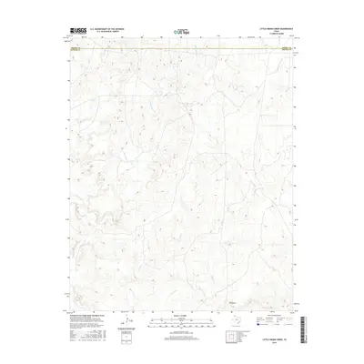
2016 Map of Little Indian Creek
USGS Topo · Published 2016About this map
Indian Cr and Little Indian Cr carve through the high plains of the Texas Panhandle in this 2016 topographical survey. This landscape is defined by the drainage networks of the Canadian River watershed, where seasonal watercourses like Sand Cr and Corral Cr have etched deep into the terrain. The border between Moore and Potter Counties crosses the northern portion of the sheet, marking a transition in a region historically dominated by large-scale ranching operations. The presence of Red Draw in the southeast quadrant highlights the erosional features typical of the Llano Estacado's northern edge. While contemporary in its mapping technology, the map reveals a sparsely populated area where the natural topography and water access continue to dictate the placement of roads and property boundaries.
Find a feature on this map
6 named features on this map. Tap any name to fly to it.
Don’t see what you’re looking for? This feature index may not catch every label — zoom into the map to look around manually.
Map Details
Editions of this 2016 Little Indian Creek Map
This is the sole edition of this map. No revisions or reprints were ever made.
Other maps of this area

1934 · Ady
USGS Topo · 1:62,500

1934 · Cliffside
USGS Topo · 1:62,500

1936 · Fourways
USGS Topo · 1:62,500

1936 · Cliffside
USGS Topo · 1:62,500

1936 · Ady
USGS Topo · 1:62,500

1953 · Marsh
USGS Topo · 1:24,000

1953 · Puente
USGS Topo · 1:24,000

1953 · Masterson
USGS Topo · 1:24,000

1954 · Tucumcari
USGS Topo · 1:250,000

1954 · Amarillo
USGS Topo · 1:250,000