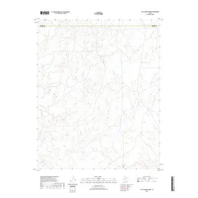
2019 Map of Little Indian Creek
USGS Topo · Published 2019About this map
The Moore Co Potter Co boundary line divides the High Plains landscape of the Texas Panhandle in this 2019 survey. The terrain is defined by an intricate network of drainage systems that carve through the plateau, most notably Little Indian Cr and the wide-reaching Sand Cr. These intermittent watercourses, including Indian Cr and Corral Cr, are central to the region’s topography, illustrating the natural erosion patterns of the Llano Estacado. The absence of built settlements or primary highways highlights the undeveloped, rural character of this northern Potter County area, where the geography is dictated by features like the Red Draw. This map serves as a detailed record of the natural drainage and elevation changes before any further modern modification, preserved through the National Geospatial Program.
Find a feature on this map
6 named features on this map. Tap any name to fly to it.
Don’t see what you’re looking for? This feature index may not catch every label — zoom into the map to look around manually.
Map Details
Editions of this 2019 Little Indian Creek Map
This is the sole edition of this map. No revisions or reprints were ever made.
Other maps of this area

1934 · Ady
USGS Topo · 1:62,500

1934 · Cliffside
USGS Topo · 1:62,500

1936 · Fourways
USGS Topo · 1:62,500

1936 · Cliffside
USGS Topo · 1:62,500

1936 · Ady
USGS Topo · 1:62,500

1953 · Marsh
USGS Topo · 1:24,000

1953 · Puente
USGS Topo · 1:24,000

1953 · Masterson
USGS Topo · 1:24,000

1954 · Tucumcari
USGS Topo · 1:250,000

1954 · Amarillo
USGS Topo · 1:250,000