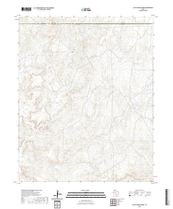
2022 Map of Little Indian Creek
USGS Topo · Published 2022About this map
Little Indian Creek carves a central path through this section of the Texas Panhandle, defining a landscape of drainage systems that flow across the Moore and Potter County line. The terrain is characterized by a dense network of intermittent watercourses and draws, including Indian Creek to the west and the wandering path of Sand Creek. These waterways and their associated breaks illustrate the erosional patterns common to the High Plains, where the surface is etched by Corral Creek and the southern reach of Red Draw. The absence of developed townsites or major highways on this sheet underscores the area's continued use as rangeland or open country, where topographic detail and natural drainage remain the primary landmarks for navigation and land management.
Find a feature on this map
6 named features on this map. Tap any name to fly to it.
Don’t see what you’re looking for? This feature index may not catch every label — zoom into the map to look around manually.
Map Details
Editions of this 2022 Little Indian Creek Map
This is the sole edition of this map. No revisions or reprints were ever made.
Other maps of this area

1934 · Ady
USGS Topo · 1:62,500

1934 · Cliffside
USGS Topo · 1:62,500

1936 · Fourways
USGS Topo · 1:62,500

1936 · Cliffside
USGS Topo · 1:62,500

1936 · Ady
USGS Topo · 1:62,500

1953 · Marsh
USGS Topo · 1:24,000

1953 · Puente
USGS Topo · 1:24,000

1953 · Masterson
USGS Topo · 1:24,000

1954 · Tucumcari
USGS Topo · 1:250,000

1954 · Amarillo
USGS Topo · 1:250,000