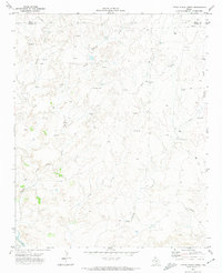
1971 Map of Little Indian Creek
USGS Topo · Published 1974About this map
Bivins X L Ranch anchors the eastern side of this Panhandle landscape, representing the storied cattle ranching traditions of the region. Surveyed in the early 1970s, the terrain is defined by a dense network of drainages including Little Indian Creek, Sand Creek, and Corral Creek which flow toward the Canadian River at the southern edge of the map. The map captures a moment of active industrial development in the Texas Panhandle's energy sector. Numerous Gas Wells and Drill Holes are scattered across the high plains and dissected breaks, connected by a prominent Pipeline running through the central corridor. This documentation of early 1970s extraction infrastructure alongside established ranching lands provides a precise record of the land use patterns along the Moore and Potter County line during a period of transition.
Find a feature on this map
13 named features on this map. Tap any name to fly to it.
Don’t see what you’re looking for? This feature index may not catch every label — zoom into the map to look around manually.
Map Details
Editions of this 1971 Little Indian Creek Map
This is the sole edition of this map. No revisions or reprints were ever made.
Other maps of this area

1934 · Ady
USGS Topo · 1:62,500

1934 · Cliffside
USGS Topo · 1:62,500

1936 · Fourways
USGS Topo · 1:62,500

1936 · Cliffside
USGS Topo · 1:62,500

1936 · Ady
USGS Topo · 1:62,500

1953 · Marsh
USGS Topo · 1:24,000

1953 · Puente
USGS Topo · 1:24,000

1953 · Masterson
USGS Topo · 1:24,000

1954 · Tucumcari
USGS Topo · 1:250,000

1954 · Amarillo
USGS Topo · 1:250,000