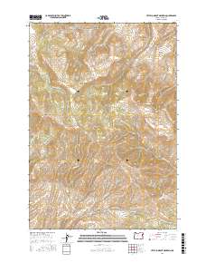
2017 Map of Little Lookout Mountain
USGS Topo · Published 2017About this map
Little Lookout Mountain and Sheep Mtn anchor this high-elevation landscape in eastern Oregon, where the terrain is defined by an intricate network of drainages and named canyons. The map reveals the complex seasonal hydrology of the region, anchored by vital water sources like Buckley Spring, McCullough Spring, and Upper Nodine Spring. These springs provided essential support for livestock and early travel through the high country. The local geography is marked by distinctive topographical features such as Kuykendahl Gulch, Box Canyon, and the sprawling reaches of Upper Timber Canyon and Lower Timber Canyon. Transportation is limited to rugged corridors like Powder River Rd and Manning Creek Rd, tracing the paths through Upper Peavine Flat and along the various forks of the Daly and Durkee creek systems.
Find a feature on this map
35 named features on this map. Tap any name to fly to it.
Don’t see what you’re looking for? This feature index may not catch every label — zoom into the map to look around manually.
Map Details
Editions of this 2017 Little Lookout Mountain Map
This is the sole edition of this map. No revisions or reprints were ever made.
Other maps of this area

1915 · Pine
USGS Topo · 1:125,000

1955 · Baker
USGS Topo · 1:250,000

1957 · Halfway
USGS Topo · 1:62,500

1957 · Sparta
USGS Topo · 1:62,500

1957 · Durkee
USGS Topo · 1:62,500

1957 · Mineral
USGS Topo · 1:62,500

1959 · Baker
USGS Topo · 1:250,000

1981 · Baker
USGS Topo · 1:100,000
1987 · Richland
USGS Topo · 1:24,000
1987 · Connor Creek
USGS Topo · 1:24,000