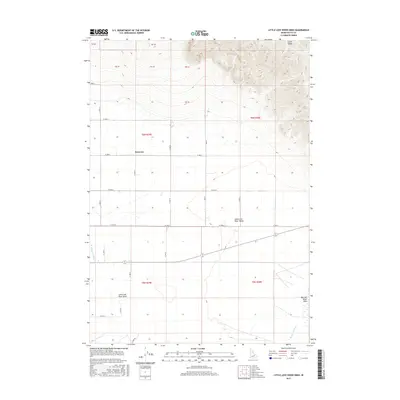
2017 Map of Little Lost River Sinks
USGS Topo · Published 2017About this map
The Lemhi Range rises sharply above the high desert floor of Butte County, dominating the northeastern portion of this Idaho landscape. Below these peaks, the Little Lost River Valley forms a wide alluvial basin where the Little Lost River eventually terminates into the Little Lost River Sinks. This endorheic drainage pattern is a defining characteristic of the region, where mountain runoff vanishes into the porous volcanic soils and gravels of the desert floor. The small settlement of Berenice sits at a crossroads of section line roads like N 1400 W and W 3900 N, serving as a remote outpost in a territory defined by large-scale public land surveys and the arid reaches of the Big Lost River Sinks. Modern infrastructure like Howe Rd connects this isolated valley to the broader region, tracing the path between the dramatic mountain front and the sink areas.
Find a feature on this map
30 named features on this map. Tap any name to fly to it.
Don’t see what you’re looking for? This feature index may not catch every label — zoom into the map to look around manually.
Map Details
Editions of this 2017 Little Lost River Sinks Map
This is the sole edition of this map. No revisions or reprints were ever made.
Other maps of this area

1955 · Idaho Falls
USGS Topo · 1:250,000

1958 · Idaho Falls
USGS Topo · 1:250,000

1969 · Little Lost River Sinks
USGS Topo · 1:24,000

1969 · Richard Butte
USGS Topo · 1:24,000

1969 · Tyler Peak
USGS Topo · 1:24,000

1969 · Howe
USGS Topo · 1:24,000

1969 · Howe NE
USGS Topo · 1:24,000

1969 · Big Lost River Sinks
USGS Topo · 1:24,000

1972 · Howe Peak
USGS Topo · 1:24,000

1973 · Circular Butte 3 NE
USGS Topo · 1:24,000