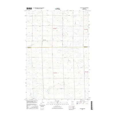
2016 Map of Little Rock
USGS Topo · Published 2016About this map
Little Rock serves as the central settlement in this portion of central Minnesota, situated where the boundary between Morrison Co and Benton Co divides the landscape. The area is defined by an intricate network of waterways, with Little Rock Cr and Kuntz Cr draining the northern reaches while Mayhew Cr and Zuleger Cr thread through the south. This 2016 survey illustrates a largely rural agricultural pattern, governed by the Public Land Survey System with roads like Nature Rd and Co Hwy 12 following section lines.
Find a feature on this map
25 named features on this map. Tap any name to fly to it.
Don’t see what you’re looking for? This feature index may not catch every label — zoom into the map to look around manually.
Map Details
Editions of this 2016 Little Rock Map
This is the sole edition of this map. No revisions or reprints were ever made.
Other maps of this area

1948 · Pierz
USGS Topo · 1:62,500

1950 · Pierz
USGS Topo · 1:62,500

1950 · St. Cloud
USGS Topo · 1:62,500

1953 · Saint Cloud
USGS Topo · 1:250,000

1953 · Stillwater
USGS Topo · 1:250,000

1955 · Stillwater
USGS Topo · 1:250,000

1957 · Saint Cloud
USGS Topo · 1:250,000

1958 · Stillwater
USGS Topo · 1:250,000

1958 · Saint Cloud
USGS Topo · 1:250,000

1965 · Stillwater
USGS Topo · 1:250,000