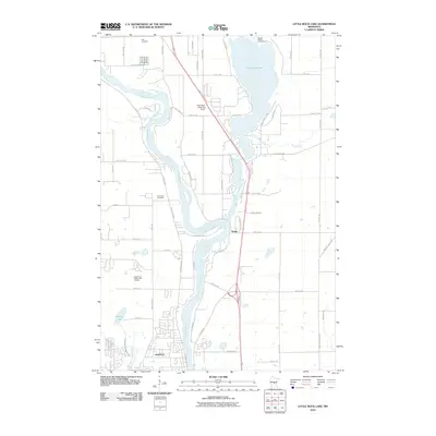
2010 Map of Little Rock Lake
USGS Topo · Published 2010About this map
The Mississippi River forms the backbone of this Benton and Stearns County landscape, winding south toward the growing community of Sartell. To the north, the expansive Little Rock Lake dominates the eastern half of the sheet, fed by Sucker Creek and Little Rock Creek. This era of the region’s development is characterized by a mix of established residential patterns and recreation, with the Benton Beach Campground situated on the lake's northern shore and the Blackberry Ridge Golf Course positioned west of the river.
Find a feature on this map
62 named features on this map. Tap any name to fly to it.
Don’t see what you’re looking for? This feature index may not catch every label — zoom into the map to look around manually.
Map Details
Editions of this 2010 Little Rock Lake Map
This is the sole edition of this map. No revisions or reprints were ever made.
Other maps of this area

1948 · Pierz
USGS Topo · 1:62,500

1948 · Little Falls
USGS Topo · 1:62,500

1950 · Little Falls
USGS Topo · 1:62,500

1950 · Pierz
USGS Topo · 1:62,500

1950 · St. Cloud
USGS Topo · 1:62,500

1953 · Saint Cloud
USGS Topo · 1:250,000

1957 · Saint Cloud
USGS Topo · 1:250,000

1958 · Saint Cloud
USGS Topo · 1:250,000

1965 · St Stephen
USGS Topo · 1:24,000

1965 · St Joseph
USGS Topo · 1:24,000