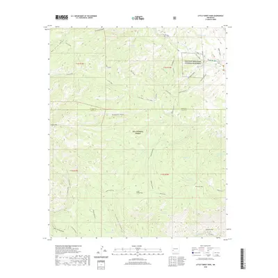
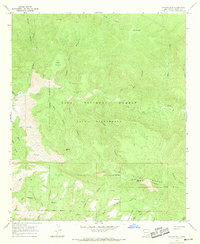
2020 Map of Little Turkey Park
USGS Topo · Published 2020About this map
The Gila Cliff Dwellings National Monument stands as the primary cultural landmark within this high-elevation wilderness in Grant and Catron counties. This 2020 survey documents the complex hydrological and topographical character of the Gila National Forest, where the W Fork Gila River and the Gila River carve through deep canyons like White Rocks Canyon and Adobe Canyon. The map reveals a landscape managed for water conservation and livestock, identified by numerous artificial catchments such as Dead Eye Tank, Locked Horns Tank, and the curiously named Crash Landing Tank. Prominent peaks including Granny Mountain and Brushy Mtn dominate the central terrain, while the W Fork Trail provides one of the few established routes through the rugged interior of Little Turkey Park.
Find a feature on this map
42 named features on this map. Tap any name to fly to it.
Don’t see what you’re looking for? This feature index may not catch every label — zoom into the map to look around manually.
Map Details
Editions of this 2020 Little Turkey Park Map
This is the sole edition of this map. No revisions or reprints were ever made.
Other maps of this area

1911 · Alum Mountain
USGS Topo · 1:125,000

1913 · Alum Mountain
USGS Topo · 1:125,000

1954 · Clifton
USGS Topo · 1:250,000

1957 · Clifton
USGS Topo · 1:250,000

1958 · Clifton
USGS Topo · 1:250,000

1962 · Clifton
USGS Topo · 1:250,000
1965 · Diablo Range
USGS Topo · 1:24,000
1965 · Copperas Peak
USGS Topo · 1:24,000
1965 · Lilley Mountain
USGS Topo · 1:24,000
1965 · Canyon Hill
USGS Topo · 1:24,000