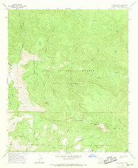
1965 Map of Canyon Hill
USGS Topo · Published 1969About this map
Indian Ruins and the high peaks of the Pinos Altos Range dominate this mid-century survey of southwestern New Mexico. The landscape is defined by the deep carving of the Gila River and its numerous tributaries, including Hells Canyon and Utah Bill Canyon. The presence of Rastas Place and various unnamed mines, marked simply as Mine or Prospect, indicates small-scale human activity within the vast Gila National Forest. This era of the Gila Wilderness is captured before modern recreational expansion, showing primitive transportation routes like the Watson Can Jeep Trail and various unnamed pack trails. High-altitude water sources such as Goose Lake, The Dry Lakes, and Slick Rock Springs provided essential points for travelers and livestock across the Packsaddle Ridge.
Find a feature on this map
68 named features on this map. Tap any name to fly to it.
Don’t see what you’re looking for? This feature index may not catch every label — zoom into the map to look around manually.
Map Details
Editions of this 1965 Canyon Hill Map
2 editions found
Other maps of this area

1909 · Silver City
USGS Topo · 1:125,000

1910 · Mogollon
USGS Topo · 1:125,000

1911 · Alum Mountain
USGS Topo · 1:125,000

1912 · Mogollon
USGS Topo · 1:125,000

1913 · Alum Mountain
USGS Topo · 1:125,000

1950 · Dorsey Ranch
USGS Topo · 1:24,000

1950 · Reading Mountain
USGS Topo · 1:24,000

1951 · Dorsey Ranch
USGS Topo · 1:24,000
1952 · Reading Mountain
USGS Topo · 1:24,000

1954 · Silver City
USGS Topo · 1:250,000