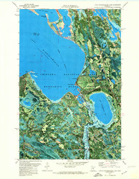
1971 Map of Little Winnibigoshish Lake
USGS Topo · Published 1974About this map
Lake Winnibigoshish dominates the western half of this 1971 orthophotomap, showing the intricate shoreline and recreational infrastructure of north-central Minnesota. The interface between Chippewa National Forest and Bowstring State Forest is clearly defined, with the Mississippi River snaking through the marshy bottomlands south of Little Winnibigoshish Lake. Local landmarks of the era include the Winnie Lookout Tower and the Fish Hatchery near Dam Bay, which served as key points for forestry and wildlife management. The map also reveals the specific development of the lakeshore, including Tamarack Campground and several named points such as Sugarbush Point and Inspiration Point. This aerial-based topography provides an exact look at the lake levels and vegetation patterns within the Leech Lake Indian Reservation, capturing the region just as outdoor recreation was becoming its primary economic driver.
Find a feature on this map
23 named features on this map. Tap any name to fly to it.
Don’t see what you’re looking for? This feature index may not catch every label — zoom into the map to look around manually.
Map Details
Editions of this 1971 Little Winnibigoshish Lake Map
This is the sole edition of this map. No revisions or reprints were ever made.
Other maps of this area

1919 · Max
USGS Topo · 1:62,500

1954 · Bemidji
USGS Topo · 1:250,000

1954 · Hibbing
USGS Topo · 1:250,000

1957 · Bemidji
USGS Topo · 1:250,000

1957 · Hibbing
USGS Topo · 1:250,000

1958 · Bemidji
USGS Topo · 1:250,000

1958 · Hibbing
USGS Topo · 1:250,000

1964 · Hibbing
USGS Topo · 1:250,000

1970 · Bowstring Lake
USGS Topo · 1:24,000

1970 · Ball Club
USGS Topo · 1:24,000