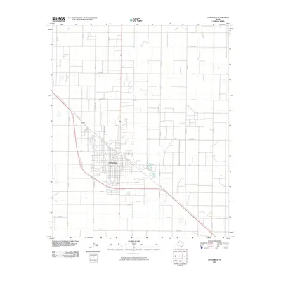
2010 Map of Littlefield
USGS Topo · Published 2010About this map
Littlefield serves as the central hub of this South Plains landscape, characterized by a structured grid of agricultural roads and residential streets. The layout of the town is defined by major thoroughfares such as N Sunset Ave, S Sunset Ave, and the diagonal orientation of W Delano Ave and E Delano Ave, which intersect the traditional street blocks. On the northern outskirts, the Littlefield Cemetery sits just off Delano and Co Rd 181, providing a key site for genealogical research. The surrounding terrain is heavily partitioned into large sections by a network of numbered county roads, including Co Rd 242 and Co Rd 312, illustrating the enduring importance of rural transport and farming connectivity in Lamb County.
Find a feature on this map
35 named features on this map. Tap any name to fly to it.
Don’t see what you’re looking for? This feature index may not catch every label — zoom into the map to look around manually.
Map Details
Editions of this 2010 Littlefield Map
This is the sole edition of this map. No revisions or reprints were ever made.
Other maps of this area

1954 · Clovis
USGS Topo · 1:250,000

1954 · Brownfield
USGS Topo · 1:250,000

1957 · Anton
USGS Topo · 1:62,500

1958 · Brownfield
USGS Topo · 1:250,000

1958 · Clovis
USGS Topo · 1:250,000

1962 · Brownfield
USGS Topo · 1:250,000

1962 · Amherst
USGS Topo · 1:24,000

1962 · Cofferville
USGS Topo · 1:24,000

1962 · Fieldton
USGS Topo · 1:24,000

1964 · Oklahoma Flat
USGS Topo · 1:24,000