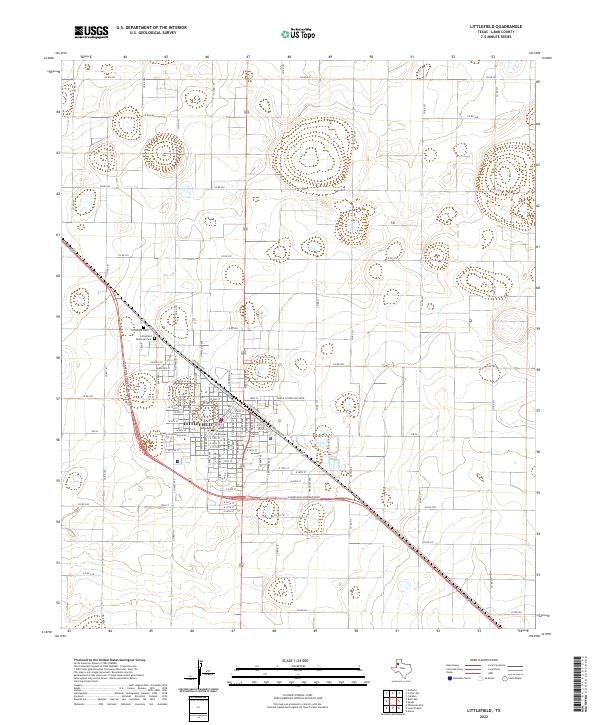
2022 Map of Littlefield
USGS Topo · Published 2022About this map
Littlefield serves as the focal point of this Lamb County study, centered on a grid of streets that honor local and national legacies. Named thoroughfares like W Waylon Jennings Blvd, Martin Luther King Blvd, and W Marshall Howard Blvd intersect the town, which is anchored by the Lamb County Courthouse. The surrounding High Plains landscape is etched with an extensive network of county roads, including Co RD 181 and Co RD 272, which form a rigid geometric pattern across the agricultural terrain. Genealogy researchers will find the Littlefield Cem and Littlefield Memorial Park on the northwestern edge of the city, providing a clear record of the community's local history and burial sites near the intersection of US Highway 84 and local roads.
Find a feature on this map
93 named features on this map. Tap any name to fly to it.
Don’t see what you’re looking for? This feature index may not catch every label — zoom into the map to look around manually.
Map Details
Editions of this 2022 Littlefield Map
This is the sole edition of this map. No revisions or reprints were ever made.
Other maps of this area

1954 · Clovis
USGS Topo · 1:250,000

1954 · Brownfield
USGS Topo · 1:250,000

1957 · Anton
USGS Topo · 1:62,500

1958 · Brownfield
USGS Topo · 1:250,000

1958 · Clovis
USGS Topo · 1:250,000

1962 · Brownfield
USGS Topo · 1:250,000

1962 · Amherst
USGS Topo · 1:24,000

1962 · Cofferville
USGS Topo · 1:24,000

1962 · Fieldton
USGS Topo · 1:24,000

1964 · Oklahoma Flat
USGS Topo · 1:24,000