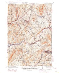
1935 Map of Littleton
USGS Topo · Published 1947About this map
The Connecticut River serves as the dividing line between Vermont and New Hampshire on this mid-1930s survey, anchoring a landscape of tight-knit river settlements and upland farm districts. Littleton stands as the primary regional hub, where the Ammonoosuc River and the Boston and Maine Railroad converge. Across the state line in Vermont, the villages of Concord and Waterford are connected by a network of rural schools, including the North Concord Sch and Slate Ledge Sch, indicating the dispersed nature of the local dairy and timber economy.
Find a feature on this map
100 named features on this map. Tap any name to fly to it.
Don’t see what you’re looking for? This feature index may not catch every label — zoom into the map to look around manually.
Map Details
Editions of this 1935 Littleton Map
4 editions found

Other maps of this area

1900 · Whitefield
USGS Topo · 1:62,500

1920 · Guildhall
USGS Topo · 1:62,500

1929 · Moosilauke
USGS Topo · 1:62,500

1929 · Franconia
USGS Topo · 1:62,500

1931 · Guildhall
USGS Topo · 1:48,000

1931 · Littleton
USGS Topo · 1:62,500

1931 · Woodsville
USGS Topo · 1:48,000

1932 · Franconia
USGS Topo · 1:62,500

1932 · Littleton
USGS Topo · 1:48,000

1932 · Moosilauke
USGS Topo · 1:62,500