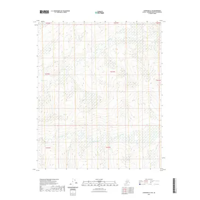
2021 Map of Livengood A-3 SW
USGS Topo · Published 2021About this map
The Chatanika River winds through the southern reaches of this interior Alaskan landscape, defining the low-lying drainage patterns of the region. This 2021 topographic record reveals a terrain shaped by significant elevation changes and seasonal watercourses, where the primary drainage of Washington Creek—also marked as Washington Cr in its upper reaches—flows toward the interior. The presence of Shorty Cr further illustrates the complex hydrological network typical of the Fairbanks North Star Borough. This map provides a technical view of the undeveloped wilderness, characterized by extensive contouring that indicates the prominent ridges and valleys typical of the Yukon-Tanana Upland before the land descends into the river basins.
Find a feature on this map
12 named features on this map. Tap any name to fly to it.
Don’t see what you’re looking for? This feature index may not catch every label — zoom into the map to look around manually.
Map Details
Editions of this 2021 Livengood A-3 SW Map
This is the sole edition of this map. No revisions or reprints were ever made.
Other maps of this area

1945 · Livengood
USGS Topo · 1:250,000

1949 · Fairbanks D-3
USGS Topo · 1:63,360

1949 · Fairbanks D-4
USGS Topo · 1:63,360

1950 · Fairbanks
USGS Topo · 1:250,000

1950 · Fairbanks D-3
USGS Topo · 1:63,360

1951 · Fairbanks
USGS Topo · 1:250,000

1951 · Livengood
USGS Topo · 1:250,000

1951 · Livengood A-4
USGS Topo · 1:63,360

1952 · Fairbanks D-3
USGS Topo · 1:63,360

1952 · Fairbanks D-4
USGS Topo · 1:63,360