
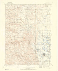
1907 Map of Livermore
USGS Topo · Published 1954About this map
Virginia Dale and the high northern reaches of the Colorado Front Range define this early 20th-century survey along the Colorado Wyoming Boundary Line. The landscape is a network of cattle and sheep ranching outposts, including the Warren Sheep Camp, Logan Road Ranch, and Springvale Ranch. Evidence of early commerce is scattered across the terrain at places like the Forks Hotel and the St Cloud P O.
Find a feature on this map
118 named features on this map. Tap any name to fly to it.
Don’t see what you’re looking for? This feature index may not catch every label — zoom into the map to look around manually.
Map Details
Editions of this 1907 Livermore Map
2 editions found
Other maps of this area

1895 · Laramie
USGS Topo · 1:125,000

1902 · Laramie
USGS Topo · 1:125,000

1902 · Greeley
USGS Topo · 1:125,000

1905 · Sherman
USGS Topo · 1:125,000

1905 · Laramie
USGS Topo · 1:125,000

1905 · Mount Olympus
USGS Topo · 1:62,500

1906 · Loveland
USGS Topo · 1:62,500

1906 · Fort Collins
USGS Topo · 1:62,500

1906 · Laramie
USGS Topo · 1:125,000

1907 · Mount Olympus
USGS Topo · 1:62,500